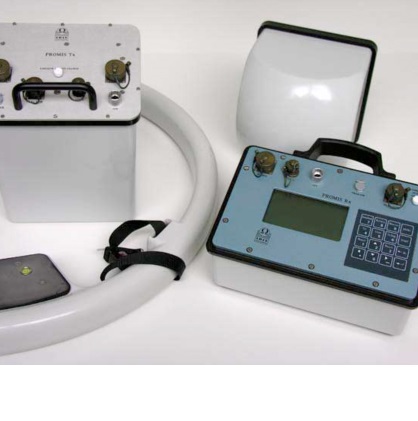


PROMIS is a slingram HLEM system.The system measures the three in-phase and out-of-phase components of the secondary magnetic field induced in the ground by conductive structures.
◇ Base and Precious Metals Exploration
◇ Diamond Exploration
◇ Environmental and Engineering Studies
◇ Reservoir Monitoring
PROMIS is a slingram HLEM system using a transmitter loop to produce a primary magnetic field, linked by a cable to a receiver sensor located at a given spacing from the transmitter;the system measures the three in-phase and out-of-phase components of the secondary magnetic field induced in the ground by conductive structures. The profile is carried out by measuring a set of frequencies at each station, and by moving both the transmitter and the receiver to the next station.
◇ The depth of penetration depends on the separation (spacing) between the transmitter and the receiver and on the frequency. Itis usually considered as of the order of half the spacing.
◇ The receiver unit controls the system and automatically carries out the readings for the set of frequencies, without any intervention of the operator and voice communication between transmitter and receiver. Two leds indicate when the transmitter has to move to the next station. Two inclinometers correct for deviations from horizontal position. A GPS unit can be connected.
◇ The productivity is increased by this automatic process. The selection of the frequencies and the stacking parameters is made at the beginning of the survey for optimizing the field work.
◇ The EMSYS software transfers, processes and displays the data.
◇ The PROMIS is available with one component(vertical)or with three components (vertical & two horizontal); the 3 component version gives more information on the geological structure.
◇ Transmitter Magnetic moment:Loop 75cm/130cm
◇ Loop diameter: 75 cm. Optional loop 130 cm for doubling the magnetic moment
◇ Inclination: 2 inclinometers for horizontal position
◇ Receiver Channels: 3 (Hx,Hy,Hz) channels (on demand)
◇ Dynamic range: 24 bits
◇ Resolution: 0.01% of the primary field
◇ GPS: GPS input for coordinates